
The Blue Star Trail
Yesterday. Today. Tomorrow. Forever.
Click Here to Register!
〰️
TOAST 2026 – August 10
〰️
Click Here to Register! 〰️ TOAST 2026 – August 10 〰️
Behind the numbers
To fund the Blue Star Trail, it takes the combined resources of public and private donors, corporations and government grants. For the full story click here.

Blue Star Trail news
The Blue Star Trail is a labor of love and a work in progress. And Friends of the Blue Star Trail, in partnership with local communities, is committed to working hard to help make the Blue Star Trail a reality. Find out what’s new here.
For more updates on the Trail’s progress, stay connected, follow us on Facebook and Instagram.
Connecting trails and people
The maps below illustrate the completed and proposed route for the Blue Star Trail and its connection to existing community trails, both to the North and from the South.
The Blue Star Trail is a Regional Connector
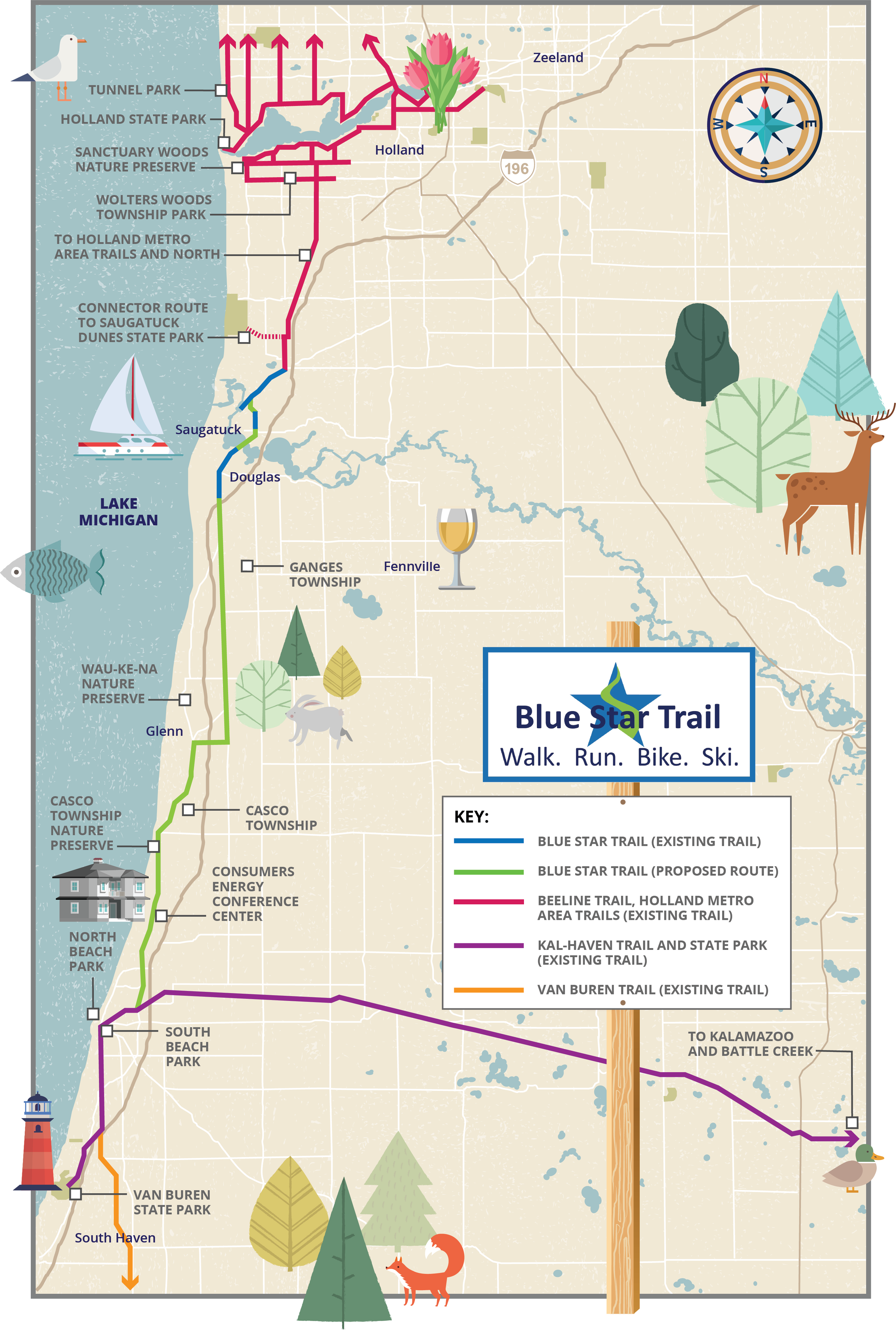
The Trail will be a paved 20‐mile off road non‐motorized shared use path running primarily along the Blue Star Highway connecting people and communities from South Haven to Saugatuck and beyond. The plan is to build contiguous sections of the Trail, going south from Saugatuck and north from South Haven.
MDOT considers the completion of the Blue Star Trail to be a high priority because it is a vital link which will connect communities in our region via existing Trails as shown above.
• East to Kalamazoo (Kal‐Haven Trail)
• South to Van Buren State Park (Van Buren Trail)
• North to Holland (Beeline Trail)
Planned Tri-Community Trail in the North
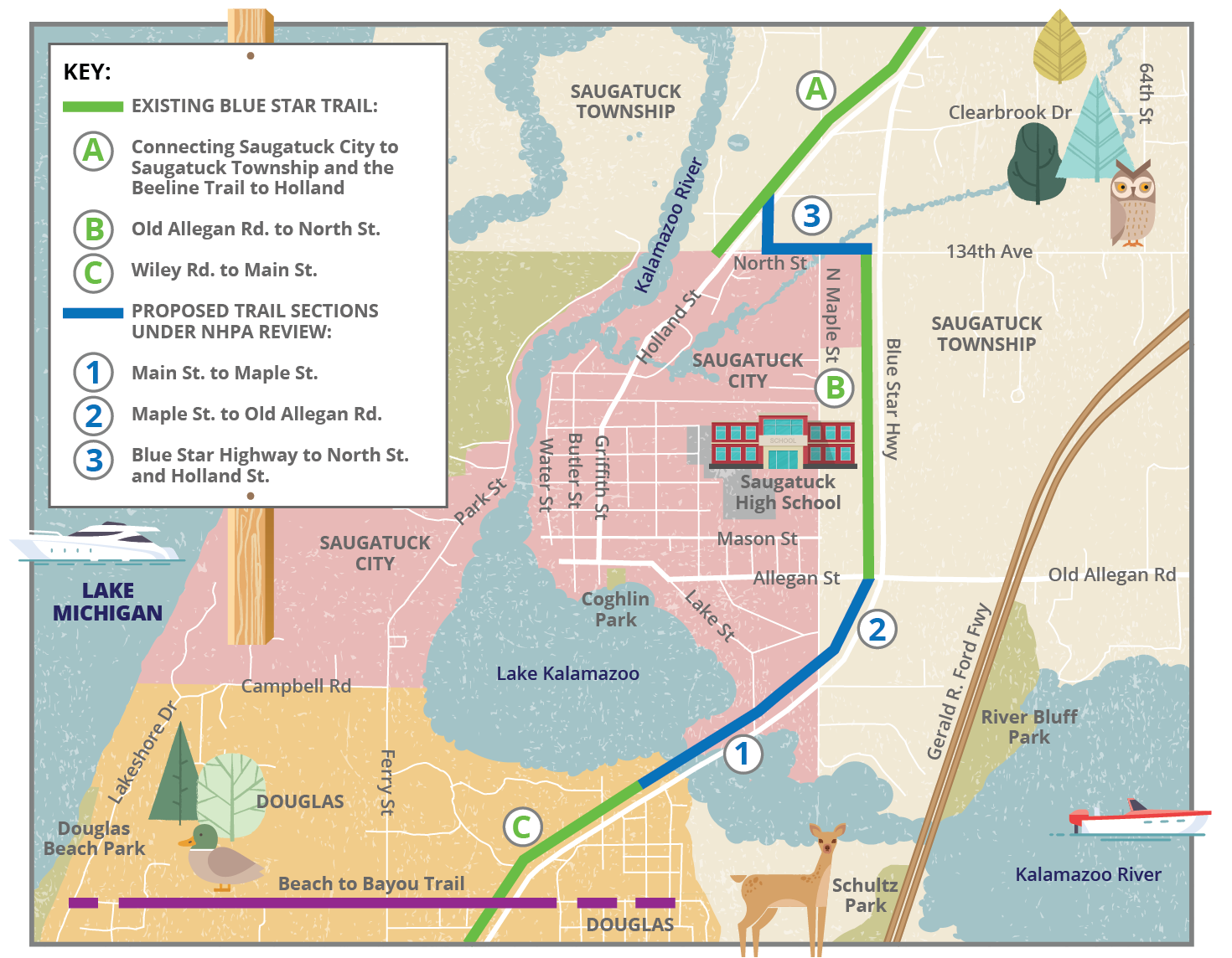
See blue segments 1, 2, & 3 on map - New section connecting from the existing trail in Douglas north across the Kalamazoo River bridge to Allegan Road. An additional new section will connect from the existing trail alongside Blue Star Highway, heading west at North Street and then north to link with the existing trail alongside Holland Street.
2nd Planned North Trail Segment
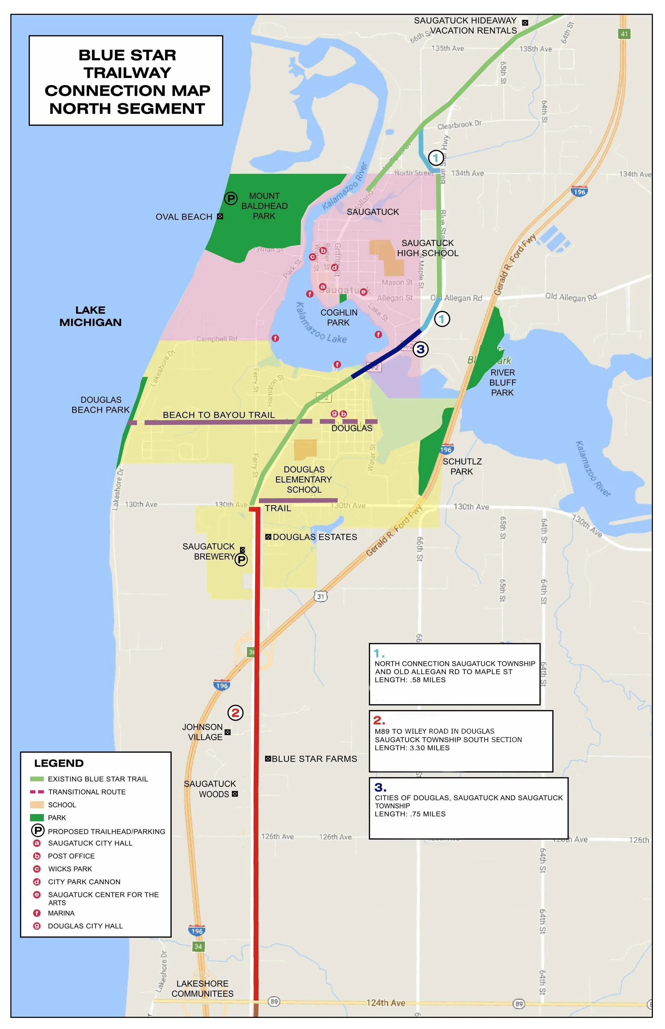
See red trail segment - this will extend the Trail south by 3 miles from Wiley Rd.
(also known as 130th Ave.) in Douglas to M-89 (also known as 124th Ave.),
which is the southern border of Saugatuck Township.
Planned Segment in the South from the Kal‐Haven Trail

This segment of Trail connects to downtown South Haven via the Kal‐Haven Trail (the southern terminus). It goes north and connects with the east/west trail running along Baseline Rd.
Friends have set aside funds for their expected local match.
Next Planned Segment in the South

Extend the Trail north by 4 miles from Baseline Rd. to the Casco Township Nature Preserve.